Lake stories
What’s under Lake Allatoona
A thousand years on the Etowah River: a Mississippian town, an iron works, a railroad battle that gave us a saying, and a federal dam that put two towns under water.
c. 1000–1550
The Etowah Mounds
Downstream of the dam, outside Cartersville, the Etowah Indian Mounds were one of the great towns of the Mississippian world, lived in from about 1000 to 1550. Mound A rises 63 feet and covers three acres at its base. Archaeologists found marble effigy statues and copper plates there, and more than a hundred stone fish weirs once crossed the river. It’s a state historic site today.
Source: Georgia State Parks; Wikipedia, “Etowah Indian Mounds.”
1840s–1864
The iron town of Etowah
The red soil at Red Top Mountain is red because of iron ore, and in the 1840s Mark Anthony Cooper built an iron town where Stamp, McKaskey and Allatoona creeks meet the Etowah River. Etowah had a blast furnace and foundry, rail and spike mills, flour mills, a bank, a church and about 1,200 people.
Cooper’s works owned the locomotive Yonah, which was sitting at Etowah Depot on April 12, 1862, when Confederate pursuers took it over in the Great Locomotive Chase. Union troops burned Etowah in May 1864, and it was never rebuilt.
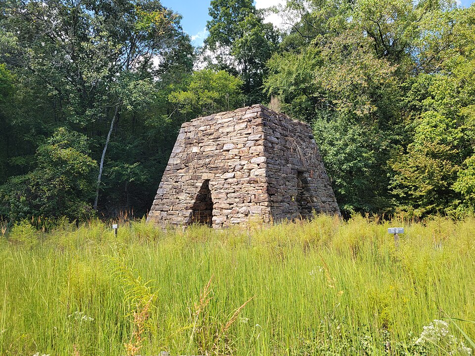
Its ruins are under the lake near the dam. The furnace stack still stands at Cooper’s Furnace Day Use Area, just below the dam.
Sources: Etowah Valley Historical Society; Georgia Historical Society; Georgia State Parks.
October 5, 1864
Hold the fort
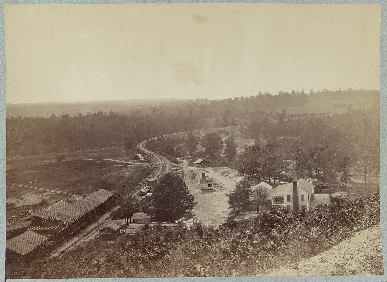
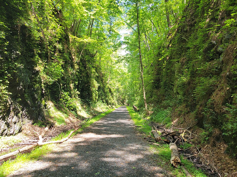
The Western & Atlantic Railroad crossed the ridge at Allatoona Pass through a “Deep Cut” blasted through solid rock. In the fall of 1864 it guarded a Union supply depot. On October 5, Union Brig. Gen. John M. Corse held the cut and its forts against Maj. Gen. Samuel French’s Confederate division.
Sherman’s signal to the garrison, remembered as “Hold the fort, for I am coming,” inspired Philip P. Bliss’s 1870 hymn “Hold the Fort,” and the phrase has been in the language ever since. The exact wording is disputed, and Sherman never sent the reinforcements.
The battlefield is managed by Red Top Mountain State Park, off I-75 at Exit 283. You can walk the cut, climb to the Star Fort and see the Clayton-Mooney House, the only building left from the town of Allatoona.
Sources: Georgia Historical Society; Georgia State Parks; Mental Floss; Deseret News.
1941–1950
Building the dam
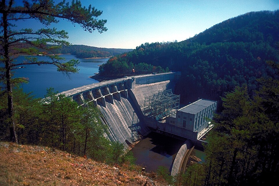
Congress authorized a dam on the Etowah in the Flood Control Acts of 1941 and 1944. War pushed construction back to 1946; the dam was finished in late 1949, the lake filled that winter and spring, and the powerhouse was running in 1950. It cost $31.5 million.
The water covered the railroad village of Allatoona, founded in 1838, and the ruins of Etowah. The same year the Corps built a small second dam at Acworth, creating Lake Acworth to cover the mudflats the rising and falling lake would leave behind: a lake inside a lake.
Sources: U.S. Army Corps of Engineers; Wikipedia, “Lake Allatoona” and “Lake Acworth.”
When the water goes down
- Old US 41 runs straight into the lake at the Old Hwy 41 recreation area, where the highway used to cross before the water came.
- In the drought of the 1980s, old Allatoona roads, house foundations and stumps came back above the water.
- Every winter at 823 ft, points and old roadbeds reappear around the lake. Run slowly in the upper arms.
And on screen
J.D.’s on the Lake, across the road from Little River Marina in Canton, played the Blue Cat Lodge in Netflix’s Ozark. You can tie up and eat there in season.
Lake Allatoona by the numbers
- 12,000acres
- 270miles of shoreline
- 145 ftdeepest point
- $31.5Mcost of the dam